
Start here
Key Takeaways
Austin’s major music festivals — Austin City Limits in October and SXSW in March — create significant road closures and traffic delays across central Austin. Zilker Park spans over 350 acres for the ACL Festival, and getting there requires deliberate planning. Austin Bergstrom Airport sits about 7-10 miles southeast of the downtown area, making ground transportation your first real decision.
- The best ways to reach Zilker Park and downtown venues are official shuttles, CapMetro public transit, rideshare to designated drop-off zones, or walking from nearby neighborhoods.
- Most visitors staying in downtown Austin, South Congress, or the East Side do not need a rental car.
- Avoid driving and parking directly at big festivals like Austin City Limits; use shuttles, rideshare, or walking from downtown instead.
- Expect heavy congestion during noon to 2 p.m. arrivals and 9 p.m. exits at major festival grounds.
- Policies, road closures, shuttle schedules, and pickup zones change every festival year — always confirm details via official sources before you travel.
At a glance
Planning Snapshot
- Event zones: Zilker Park for Austin City Limits, downtown streets and clubs on Red River for SXSW, Moody Center for stadium-scale shows, and the Moody Theater and Long Center for indoor concerts.
- Transportation modes: Official festival shuttles, CapMetro public transit, rideshare and taxis, walking and biking, and driving with parking each play a role depending on your venue and neighborhood.
- Timing considerations: Downtown street closures and one-way changes reduce drivable routes during SXSW and ACL, parking becomes scarce and expensive, and rideshare demand surges after headliners with waits stretching past 30 minutes.
Reference
Quick Facts
- Airport: Austin-Bergstrom International Airport (AUS), roughly 7-10 miles from downtown depending on your route and destination.
- Venues: Zilker Park (350+ acres), Moody Theater, Moody Center, the Long Center, and the club corridor along Red River.
- Transit options: Rideshare pickup zones, app-based taxis, CapMetro Route 20, MetroRapid 801/803, MetroRail, and pre-booked private car services.
- Parking: Downtown parking is scarce and expensive during SXSW, with similar conditions during ACL weekends.
- Timing: Allow a buffer of 90 minutes or more between landing and your first showtime; expect heavy congestion around noon-2 p.m. arrivals and 9 p.m. exits.
Overview
Trip-Planning Overview
This guide is for anyone planning an Austin music weekend — ACL at Zilker Park, shows at Moody Theater, club nights on Red River, stadium events at Moody Center — and trying to choose the right transportation mix. Festival season reshapes Austin transportation in predictable ways: downtown street closures and one-way changes reduce drivable routes during SXSW and ACL, downtown parking becomes scarce and expensive (especially during SXSW), rideshare demand surges after headliners with wait times stretching past 30 minutes, and public transit service is often increased during major festivals, though late-night coverage has limits.
Your three main decision points: where you’re staying (downtown, South Congress, East Side, Hill Country), which venues you’re focused on, and your group size. Core transportation options around Austin break down into public transit via CapMetro, rideshare and taxis, walking and biking, and driving with parking. Each has clear tradeoffs covered in detail below.
Austin Bergstrom is the main gateway for Central Texas music trips. Most visitors don’t need a rental car unless they’re heading deep into the hill country or staying far from core neighborhoods. See the Austin city guide for neighborhood breakdowns and venue maps to help plan routes between hotels, gates, and shuttle stops, and check the Austin City Limits festival page before you book to match hotels with gates and shuttle stops.
Landing
Airport Arrival
Austin Bergstrom International Airport (AUS) is the primary airport for festival trips, roughly 7-10 miles from downtown depending on your route and destination. Austin Bergstrom International Airport offers non-stop flights from fifty cities, and festival weekends bring heavy arrival surges.
- Thursday and Friday see the biggest influx for ACL and SXSW; Monday departures come with heavier security lines.
- Late-night arrivals on Sundays may face limited ground transportation options.
- Cell networks at the airport can get congested on peak festival days.
Your primary transportation options from AUS include rideshare pickup zones (located near the Red Garage area), app-based taxis, CapMetro Route 20 into downtown, and pre-booked private car services. Travel time varies widely with festival traffic and road closures, so allow a generous buffer — often 90 minutes or more — between landing and your first showtime.
Travelers arriving late at night should double-check public transit end times and plan how they will arrive at their hotel or first venue if buses have stopped running. Groups arriving together should coordinate baggage claim and pickup via messaging before landing.
Budget-friendly
Public Transit
CapMetro is Austin’s public transportation provider, covering buses, MetroRapid lines, and the MetroRail commuter rail. It works well for budget-conscious travelers staying near major corridors. Public transit options include eleven high-frequency bus routes running every 15-30 minutes during daytime.
- Airport Route 20 connects Austin Bergstrom Airport to downtown — slower than rideshare but far cheaper.
- MetroRapid 801 and 803 move people along the North Lamar/South Congress spines, useful for avoiding rideshare surge between downtown and neighborhoods like South Lamar or Burnet Road.
- MetroRail serves visitors staying or parking north of the city, with a downtown-adjacent stop near the convention center. During ACL, last MetroRail trains depart downtown around 12:30 a.m.
- CapMetro buses cost $2.50 per day for unlimited rides — one of the best deals for festival attendees moving between venues.
During SXSW, the SXSW Shuttle runs every 10-15 minutes from 9 a.m. to 2:30 a.m., and public transit costs $2.50 per day. Using the CapMetro app is useful for navigating public transit — you can buy passes, track multiple vehicles in real time, and monitor detours during events. CapMetro operates bus and rail services throughout Austin, but late-night coverage drops off on some bus routes after major shows. Always cross-check routes and times on CapMetro.org shortly before your trip because schedules shift regularly.
On foot and pedal
Bike and Walking Considerations
Walking is often the fastest way to get between venues during festivals, especially when road closures make driving impractical. SXSW transforms central Austin into a pedestrian-first zone, and ACL weekends push similar foot traffic patterns around Zilker Park and South Lamar.
- Downtown to Zilker Park is roughly 1.5-3 miles depending on your gate — a 25-45 minute walk.
- October weather for ACL is typically warm during the day and cooler at night; March for SXSW tends to be mild. Bring comfortable shoes, sunscreen, and water.
- Biking is a viable transportation option in Austin with bike-share programs. CapMetro bikeshare has over 75 stations across Austin, and ACL weekends add valet bike stations near festival entrances.
Crowded festival nights, wet weather, and alcohol can make scooters risky. If balance or visibility is compromised, choose walking or rideshare instead. Stick to marked bike lanes along corridors like South 1st, Riverside, and the Ann and Roy Butler Hike-and-Bike Trail rather than cutting across dark side streets near the river. Confirm local rules for scooter parking and sidewalk riding to avoid tickets, and keep curb cuts clear for wheelchair users. Don’t forget to pack your essentials — a festival gear checklist covers what to carry for long days on foot.
Behind the wheel
Driving and Parking
VewTopia may earn a commission if you book through links on this page, at no extra cost to you.
Driving gives the most control when you’re staying far from the city core or exploring the hill country, but downtown parking during major festivals is limited, pricey, and stressful. Parking in downtown Austin is scarce and expensive during SXSW, and conditions are similar for ACL weekends.
- A rental car makes sense for multi-day itineraries across Central Texas, winery runs, or travelers housed in outlying suburbs like Cedar Park or Round Rock with minimal transit coverage.
- Big shows at Moody Theater, Moody Center, or the Long Center can fill nearby garages early. Expect high rates and slow post-show exits.
- Significant road closures and traffic delays are common during major festivals — Barton Springs Road, Stratford Drive, and sections of MoPac frontage roads close during ACL. Check the City of Austin event street closure maps for updates.
Strategies for a smoother experience: park once on the edge of downtown and walk or rideshare in, share one car among a group rather than caravaning with multiple vehicles, and factor in extra time for exiting garages after headliners. Avoid drinking and driving, especially on winding hill country roads. Professional drivers from private car companies can handle late-night returns if you plan ahead.
Learn how to pair hotels and transportation choices using the hotels and transportation guide, which explains how to match parking availability with room locations.
Home base
Zilker and Major-Event Logistics
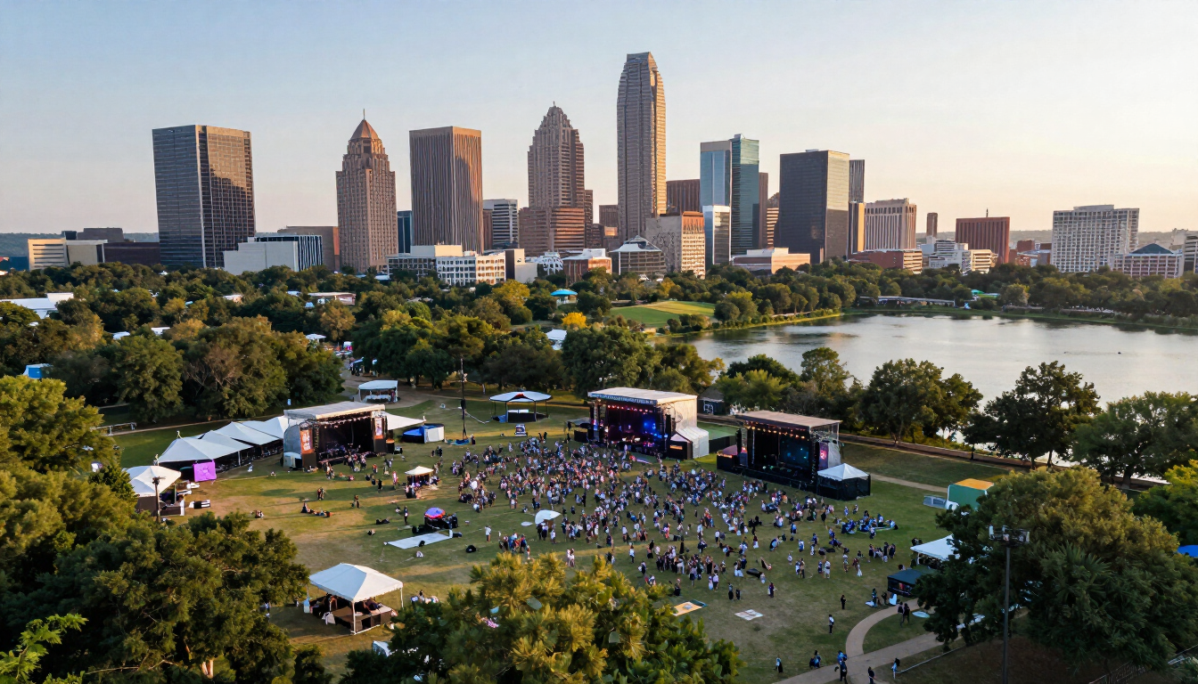
Zilker Park is home base for Austin City Limits and the focal point for big outdoor music weekends in town, with logistics very different from indoor downtown venues. The festival grounds cover the park’s 350-plus acres with three main entrances:
- Barton Springs West — served by the official ACL shuttle from Republic Square in downtown Austin.
- Barton Springs East — accessible via walking from South Lamar or rideshare drop zones.
- Lady Bird entrance — closest for those coming from the east side of the park.
The official ACL shuttle picks up at Republic Square. Shuttles run from noon on Fridays and 11 a.m. on weekends, though exact times shift yearly. Festival shuttles provide convenient transportation but queues grow fast, especially mid-afternoon.
Roads closest to the park close to through traffic. Riders should expect to walk 5-15 minutes from legal drop-off points. Arriving early and planning ahead can help you avoid the heaviest security and shuttle lines. Set a meeting point with your group in advance — cell networks get overloaded during peak entry and exit.
SXSW and stadium shows each publish their own official map with shuttle routes and pickup zones. Always review those in advance. Check the Austin City Limits festival page for that year’s shuttle details, gate times, and neighborhood tips before finalizing your plan.
Getting home
Post-Event Pickup Plan
Leaving a show in Austin — especially at Zilker Park, Moody Center, or downtown street festivals — often takes longer than arriving. Festival traffic after headliners is intense, and exit planning deserves the same attention as arrival planning.
- Choose a post-show meeting point before the headliner starts, ideally a recognizable corner or business 2-3 blocks from the main exit to avoid the thickest crowded areas.
- Decide in advance whether you’ll walk to a less congested area for rideshare, head to a pre-booked parking spot, or return by shuttle or public transit. Share that plan with your whole group.
- At Zilker Park, large crowds head to shuttle queues while rideshare zones back up on nearby streets. Those who leave during the last few songs of the final set typically exit faster.
- Build a backup option: a second pickup spot or a willingness to walk toward downtown along well-lit routes if primary zones are overwhelming.
Keep phones charged with an external battery and agree on a fallback meeting place near the hotel in case messages don’t go through. The Vewtopia guides hub includes other city and festival planning resources that can help you adapt similar exit strategies to your next live music trip.
Plan ahead
Accessibility and Group Logistics
Many attendees travel with mobility needs, large friend groups, or family members. Austin’s music infrastructure offers options but requires advance planning.
- ADA entrances at Zilker Park, accessible shuttle options, and companion seating are typically available during ACL. Policies change year to year — check official venue and festival accessibility pages before you travel.
- Request wheelchair-friendly premium vehicles from rideshare or private-car providers well in advance. Some drop-off zones are more accessible than others.
- For groups, consolidate pickups across downtown Austin, East Side, and suburbs. Choose the right vehicle size — SUV, van, or minibus — based on passenger count and any festival gear like instruments or strollers.
- Private transportation allows for flexible scheduling during events and can be more cost-efficient for groups than booking multiple rideshares, especially after long days and late nights.
Assign a “logistics lead” in each group who manages meeting points, ride bookings, and communication so everyone else can focus on the music. Use the hotels and transportation resources to match group size and mobility needs with lodging and a movement plan across an Austin music weekend.
Answered
FAQ
Do I need a rental car for an Austin City Limits weekend?
Most visitors who stay in downtown Austin, South Congress, or along key bus and rideshare corridors can skip a car entirely. Shuttles, walking, rideshare, and bikes cover the core festival route well. A car becomes more useful if you're planning hill country side trips or staying in remote lodging far from transit lines.
How early should I leave for Austin-Bergstrom after a Sunday headliner?
Build a generous buffer. Shuttle queues, rideshare waits of 20-40 minutes, and airport security lines on busy festival Mondays can eat time fast. If your flight is early Monday, consider a late-morning or afternoon departure instead. Leaving the festival grounds 30-45 minutes before the final set helps, but even then the ride to Austin Bergstrom can take longer than usual.
Is it safe to walk between downtown Austin and Zilker Park at night?
Many festival-goers walk this route along well-traveled streets like Barton Springs Road. Stay in groups, use lit paths, and avoid poorly lit shortcuts near the river. Ask hotel staff for the best current walking routes, since closures and detour paths can shift each year based on the schedule of events.
Where should I stay if I want to minimize transportation hassles?
Downtown Austin, South Congress, or the Zilker/Barton Springs area give you easy access to shuttles, walkable routes, and short rideshare hops. Visit the Austin destination page for neighborhood breakdowns and hotel suggestions matched to specific venue clusters.
How far in advance should I book transportation for major Austin festivals?
Once you buy passes or confirm wristbands, immediately look at lodging and transportation. Festival weekends sell out hotel rooms fast and strain rideshare supply across the city. Revisit your plan closer to the event as official shuttle and transit details are published, since CapMetro and ACL typically release updated route maps and service hours a few weeks before each October weekend.
Official sources and update log
This is independent trip-planning guidance, not an official transit or venue resource. Schedules, road closures, shuttle routes, and transit details should be reconfirmed via official sources before travel. Festival-year changes are common.
Official sources
- CapMetro transit schedules and ACL service enhancements: capmetro.org
- Austin-Bergstrom International Airport ground transportation: flyaustin.com
- City of Austin street closures and event mobility: austintexas.gov
- ACL Festival transportation FAQ: support.aclfestival.com
Required internal links
- /destinations/austin/ — linked in Trip-Planning Overview and FAQ
- /festivals/austin-city-limits/ — linked in Trip-Planning Overview and Zilker section
- /concert-travel/hotels-and-transportation/ — linked in Driving and Accessibility sections
- /festival-gear/ — linked in Bike and Walking section
- /guides/ — linked in Post-Event Pickup section
Affiliate placement notes
No affiliate links placed. Approved transportation partner links (private car service, parking apps, accessible vehicle booking) can be inserted at natural placements — Rideshare and Pickup Zones (private car service mention), Driving and Parking (parking reservation tools), and Accessibility and Group Logistics (accessible vehicle booking) — once partners are confirmed. Disclosure is placed before any potential commercial link in the Driving and Parking section.
VewTopia may earn a commission if you book through links on this page, at no extra cost to you.
Update log
2026-07: Initial publication covering airport arrival, public transit, rideshare and pickup zones, bike and walking considerations, driving and parking, Zilker and major-event logistics, post-event pickup planning, and accessibility and group logistics for Austin's biggest music weekends.
Last verified: July 2026